Map
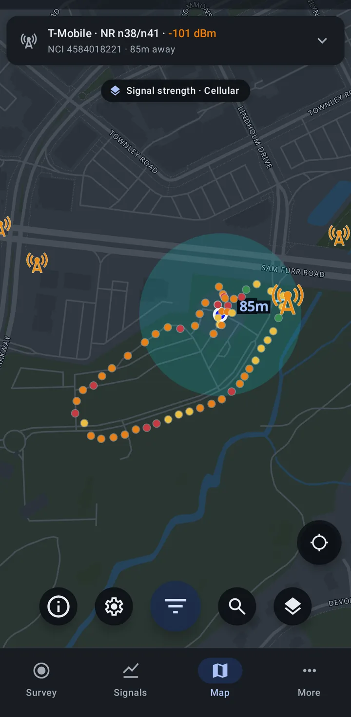
The Map tab shows where you are, the cell towers around you, the tower your phone is connected to, and the places your surveys have covered. It needs an internet connection to load map tiles and towers, and location turned on to show your position.
What is on the map
Section titled “What is on the map”- Serving cell card at the top (see below), when the phone has a serving cell.
- A banner when location is off, with a button to turn it on.
- The survey points pill under the card, such as “Signal strength · Cellular”, while My survey points has points to show.
- Your location and the cell towers in view.
- The serving tower, highlighted, with a dashed line from you to it labeled with the distance (in the units you chose in Settings). A coverage circle around it can be turned on or off in Map settings.
- On the right, Follow my location, which keeps the map centered on you (tap again to stop following), and zoom buttons if you turned them on in Map settings.
- Along the bottom, round buttons for About the map, Map settings, Filters (the larger button in the middle), Search for a tower, and Layers. Search only shows while the Towers layer is on, and Filters while Towers or My survey points is on.
Serving cell card
Section titled “Serving cell card”Collapsed, the card shows two lines: the operator, technology and band, and signal, then the cell’s identity and how far away its tower is, for example “T-Mobile · NR n38/n41 · -101 dBm” and “NCI 4584018221 · 85m away”. For LTE the second line names the eNB and sector. On a phone with more than one SIM it also names the SIM.
Tap the card to expand it for the cell’s details and, on a phone with more than one SIM that has a serving cell, a choice of which SIM to show.
A NEW tag appears when the tower is new to OpenCelliD (see New tower alerts).
Towers
Section titled “Towers”Tower locations come from crowd-sourced databases: OpenCelliD worldwide, and BTSearch for Poland. The locations are estimated from survey results and can be off, so check another source when accuracy matters.
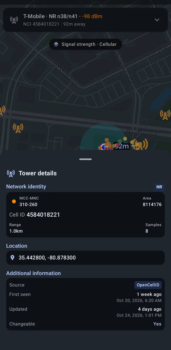
- Tap a tower to open Tower details: the network identity (MCC-MNC, area, cell ID, range, and samples), its location, and more information such as the source and when it was first seen and last updated. Tap the provider’s color dot to choose a different color for that provider.
- Stacked towers: when several towers share a spot, a badge shows how many towers are there and a second badge how many operators. Tap it for a list (“3 towers here”) and pick one to see its details.
- Towers load as you move the map. Zoomed far out, the map asks you to zoom in farther to see towers, and when an area has more towers than it can draw, it says it is showing the first ones and asks you to zoom in or narrow the filters.
Filters
Section titled “Filters”The Filters button opens a sheet with:
- Provider: show only one provider’s towers, by MCC and MNC
- Technology: show only the towers of one technology (GSM, CDMA, UMTS, LTE, or NR)
- Tower data source: OpenCelliD (crowdsourced tower data from around the world) or BTSearch (Poland) (towers in Poland only)
- Last updated: hide towers that were not updated recently. Updated within offers Any time, Within 6 months, Within 1 year, Within 2 years, and Within 5 years. This filter does not apply to BTSearch towers.
While My survey points is on, the same sheet also has the survey point filters.
Search for a tower
Section titled “Search for a tower”The search button opens Find a tower. Enter the tower’s MCC, MNC, LAC/TAC, and CID and tap Search. The map moves to the match, or says “No towers match this search.”
Layers
Section titled “Layers”The Layers button opens Map layers:
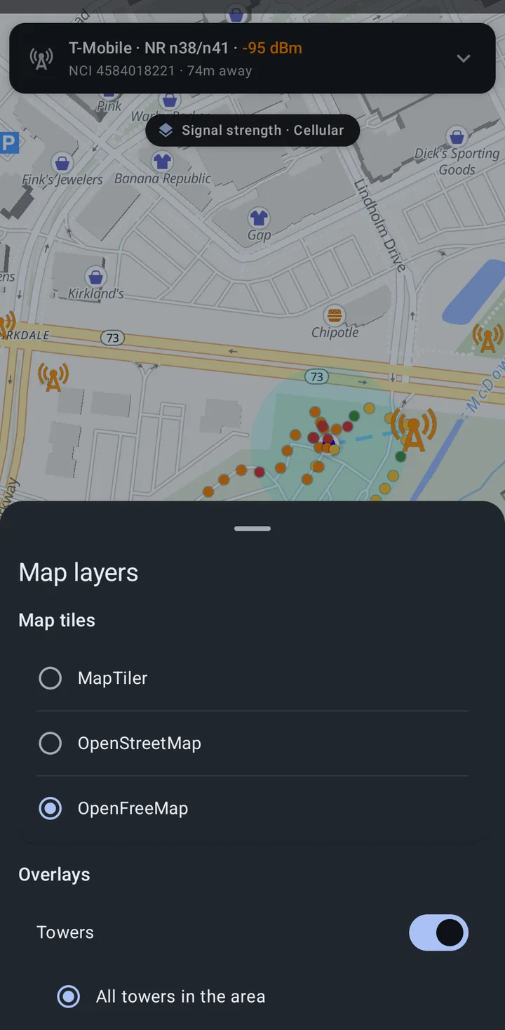
- Map tiles: MapTiler, OpenStreetMap, or OpenFreeMap. OpenFreeMap is the default, and the map falls back to it if MapTiler cannot load.
- Overlays:
- Towers (on by default), showing All towers in the area or Serving cell only (only the towers your phone is connected to).
- My survey points (on by default).
- BeaconDB coverage (off by default), an orange overlay of where BeaconDB has data.
My survey points
Section titled “My survey points”Survey points are dots that mark where your surveys have been, colored by what was heard there.
- A point is recorded about every 10 m on foot and every 35 m while driving, and only when the location fix is accurate to 100 m or better. It is a record of where you surveyed, not of every scan.
- Points stay on this device, up to 500,000. Past that, the oldest points that were already sent are removed first.
- Clear them any time with Clear survey points in Map settings. Clearing does not affect data already sent to OpenCelliD, BeaconDB, or NS Analytics.
Choosing what the colors show
Section titled “Choosing what the colors show”Tap the pill at the top of the map to open Survey points:
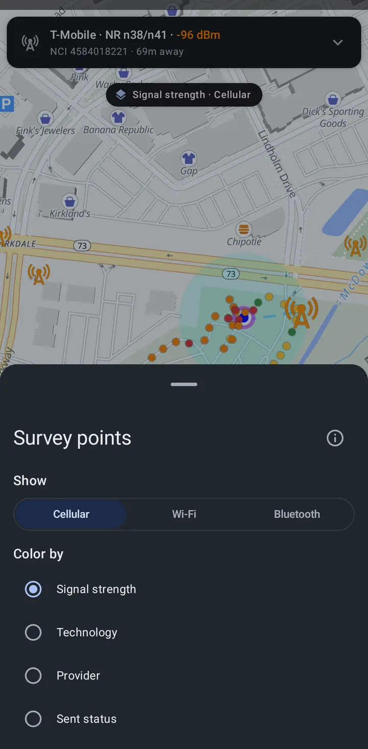
- Show: Cellular, Wi-Fi, or Bluetooth points, one kind at a time.
- Color by: Signal strength, Technology, Provider, or Sent status, and under Advanced, Cell and Area (TAC/LAC). Technology, Provider, Cell, and Area apply to cellular points only.
The sheet shows a legend for the chosen mode. For signal strength it uses the five steps the Cellular view uses (see Signal colors): for LTE and NR, Strong above -85 dBm, Good -85 to -95 dBm, Fair -95 to -105 dBm, Weak -105 to -115 dBm, and Very weak below -115 dBm. The thresholds adjust for 3G and 2G. Wi-Fi and Bluetooth points use -60, -70, -80, and -90 dBm as the step boundaries. The legend’s Unknown color marks points that have no signal value.
The info button on the sheet opens About survey points.
Survey point filters
Section titled “Survey point filters”The Filters sheet narrows the survey points with:
- When surveyed: Any time, Last hour, Last 7 days, or Latest NS Analytics survey. The latest survey option is only offered once an NS Analytics survey has recorded points. For a survey that sent only to OpenCelliD and BeaconDB, use a time range.
- Collected for: Both, OpenCelliD and BeaconDB, or NS Analytics. This choice only appears once you have points from both.
- Sent status: Any, Sent, or Not sent yet.
Active filters show as chips under the pill. Tap a chip’s close button to remove that filter.
Tapping a point
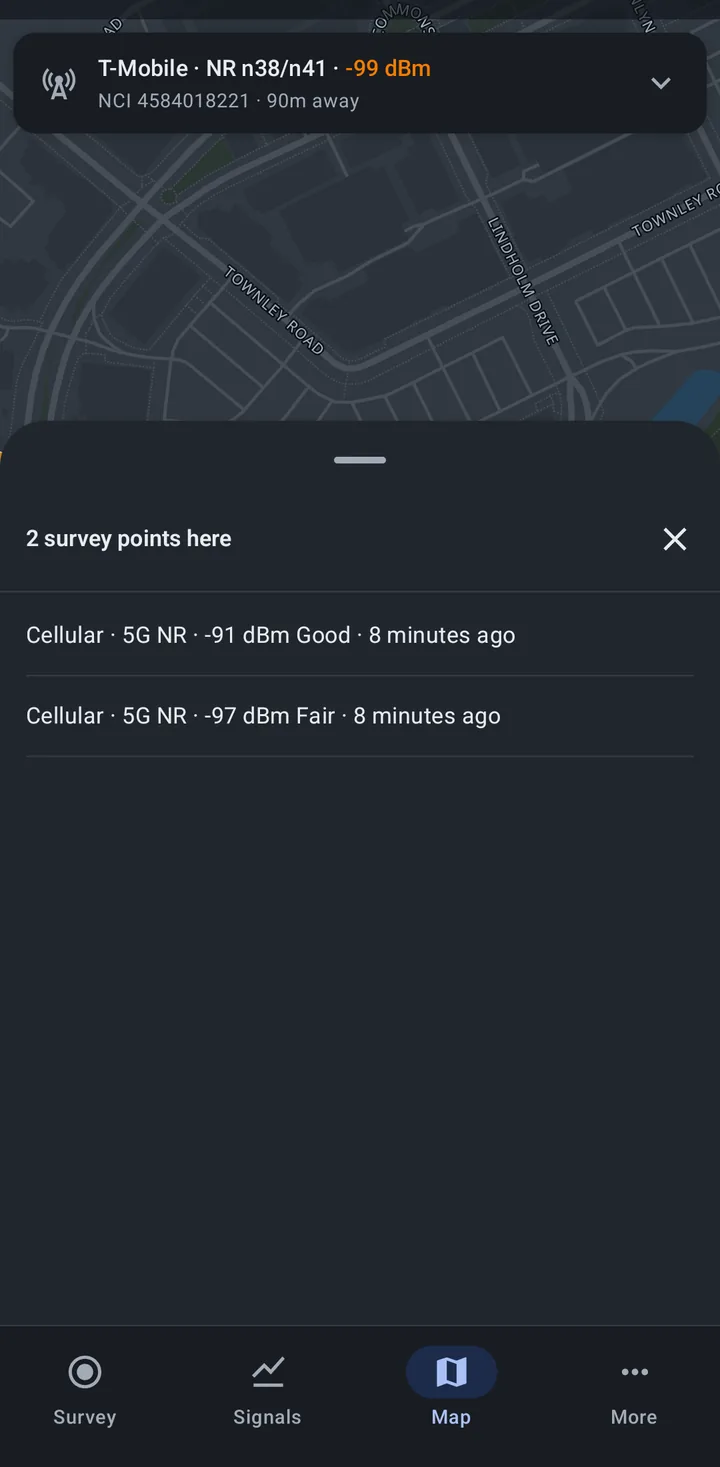
Section titled “Tapping a point”Tap a point to see what was heard there: the signal, provider, technology, cell, and area for cellular points, or the number of networks or devices heard and the strongest for Wi-Fi and Bluetooth, plus when it was surveyed, what it was collected for, and whether it was sent. Where several points overlap, a list shows them all (“2 survey points here”).
Zoomed out, each mark summarizes an area instead of one point. Tapping one shows the best signal there, the most common technology and provider, when it was first and last surveyed, and how many of its points were sent, with a reminder to zoom in for details.
About the map
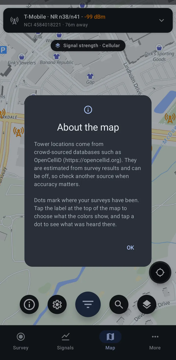
Section titled “About the map”The info button opens About the map, which repeats the note on tower accuracy and explains the survey points: tap the label at the top of the map to choose what the colors show, and tap a dot to see what was heard there.
New tower alerts
Section titled “New tower alerts”With New tower alerts turned on in Settings > OpenCelliD and BeaconDB uploads, Network Survey checks your serving cell while a survey that sends to the Community databases is running. When you connect to a tower that has not been uploaded to OpenCelliD yet, you get a “New tower found” notification and the serving cell card shows a NEW tag. See Community databases.
Related
Section titled “Related”- Map settings: screen, zoom buttons, coverage circles, and colors
- Community databases: contributing tower and Wi-Fi data
- NS Analytics: the other destination that adds survey points
- Cellular networks: the Cellular view and its signal scale
- GNSS: checking your fix quality